


A continuing series of posts to highlight my small antique map collection. All scans are taken directlly from an original copy, not a reproduction.
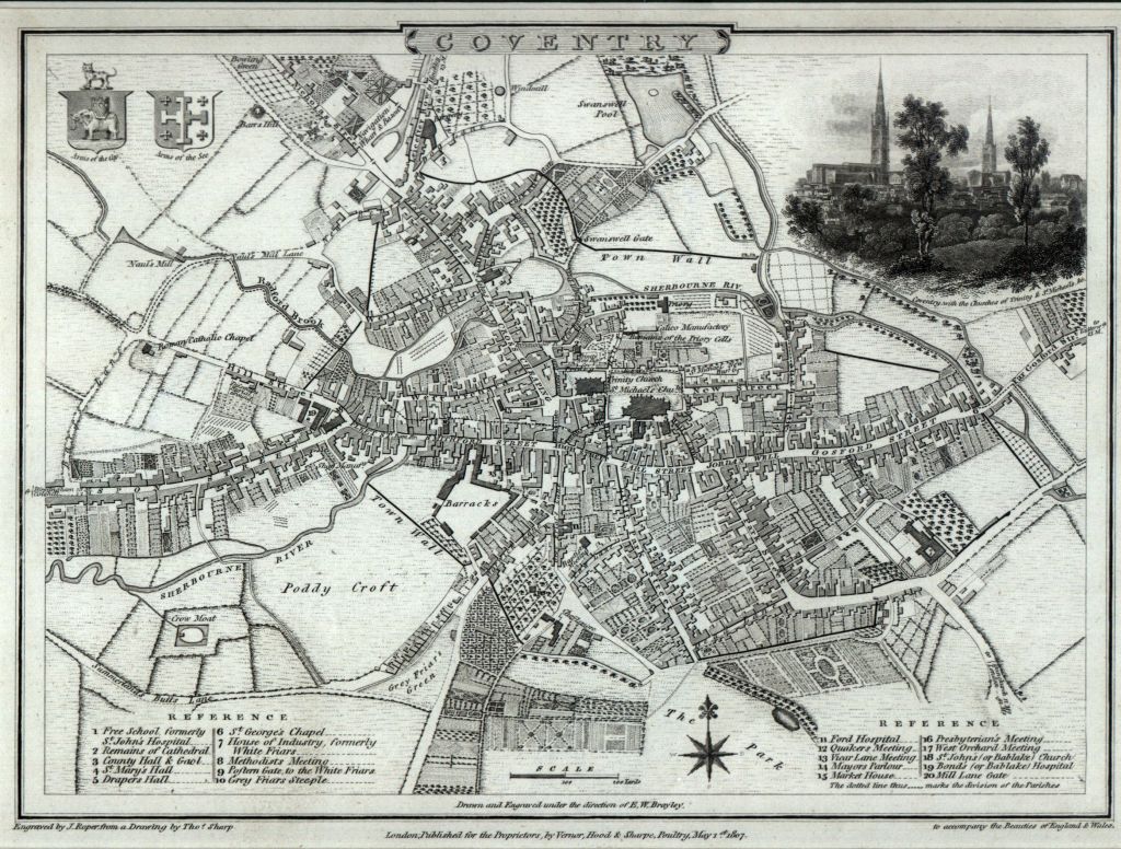
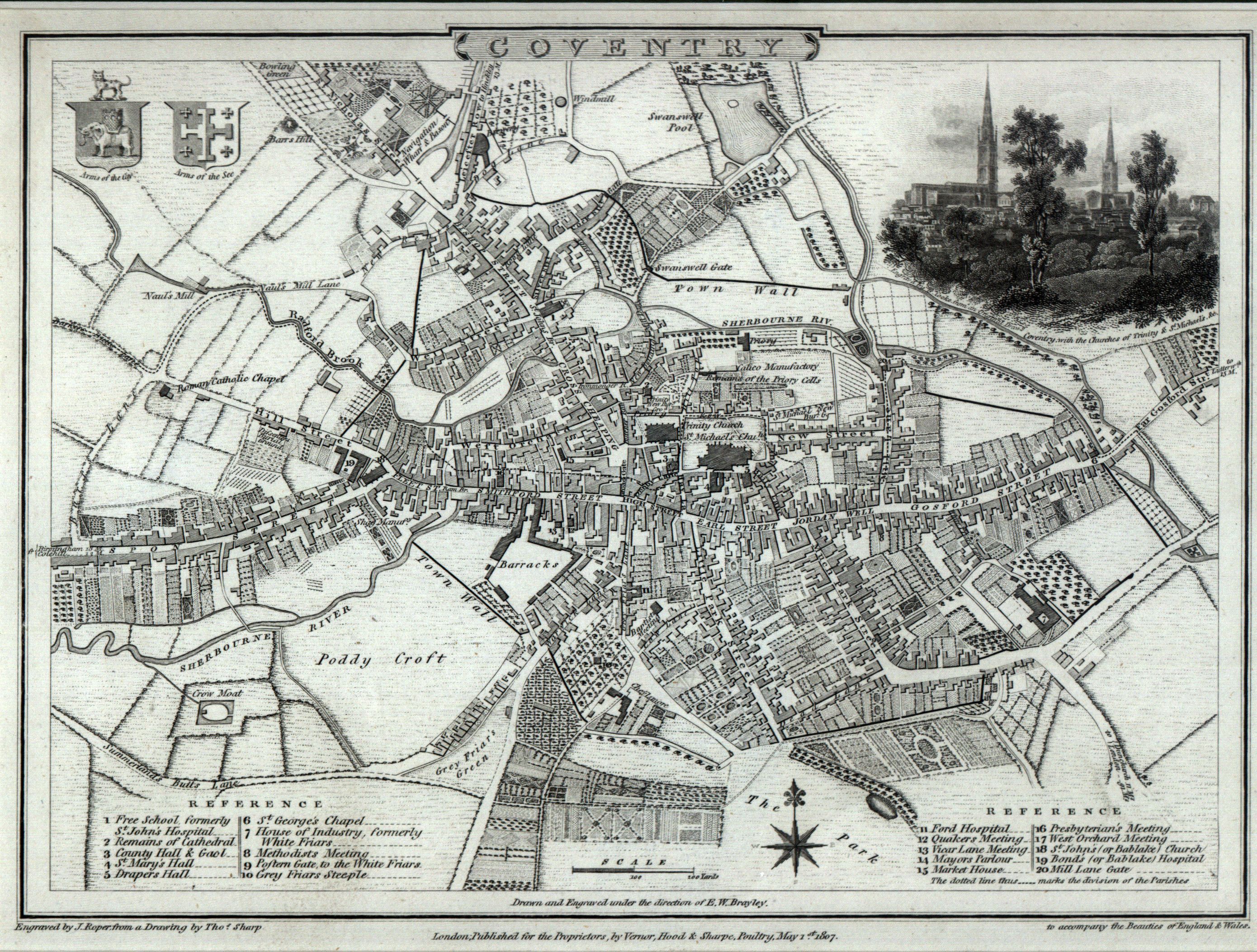
This third map in the series is also taken from “The British Atlas” by George Cole and John Roper published in 1810 (although the map carries the legend of 1807 at the bottom). This was a collection containing 58 English and Welsh county maps, some with pictorial illustrations, and 21 town plans: Bedford, Cambridge, Canterbury, Carlisle, Chester, Colchester, Coventry, Derby, Durham, Exeter, Gloucester, Hereford, Liverpool, Manchester and Salford, Newcastle upon Tyne and Gateshead, Northampton, Norwich, Oxford, St. Albans, Winchester, Worcester.
The legend “G. Cole and J. Roper to accompany “The Beauties of England and Wales” published by Venor, Hood and Sharpe, 1807″ refers to a series of volumes published in the early 1800s, Warwickshire is contained in Volume XV published in 1814, it can be found online at Googlebooks. At the time of this map the population of Coventry is a little under 18,000 (currently 309,800). Notable by its absence is the infamous ring road (built 1962 onwards) and train station (built 1838).
Explore the map below using Magic Toolbox‘s excellent plugin Magic Zoom Plus to see more detail.
..
Watch out for the next map in this series..


